The Avatar Mountains are a popular travel nickname for Zhangjiajie’s pillar scenery. To plan a visit, translate that nickname into places you can actually find on a map: Zhangjiajie in Hunan Province, the Wulingyuan scenic area, and named viewing areas such as Yuanjiajie. A hotel or ticket listing that says only “Zhangjiajie” does not tell you which part of this region you will visit.
Start with three levels of geography
Zhangjiajie is the city name used for the wider destination. Wulingyuan is the name you will encounter when researching the protected pillar landscape. UNESCO lists Wulingyuan as a World Heritage property. Zhangjiajie National Forest Park is one of the names used in visitor planning for this landscape, rather than a synonym for every attraction in the city.
A landscape, rather than a single summit
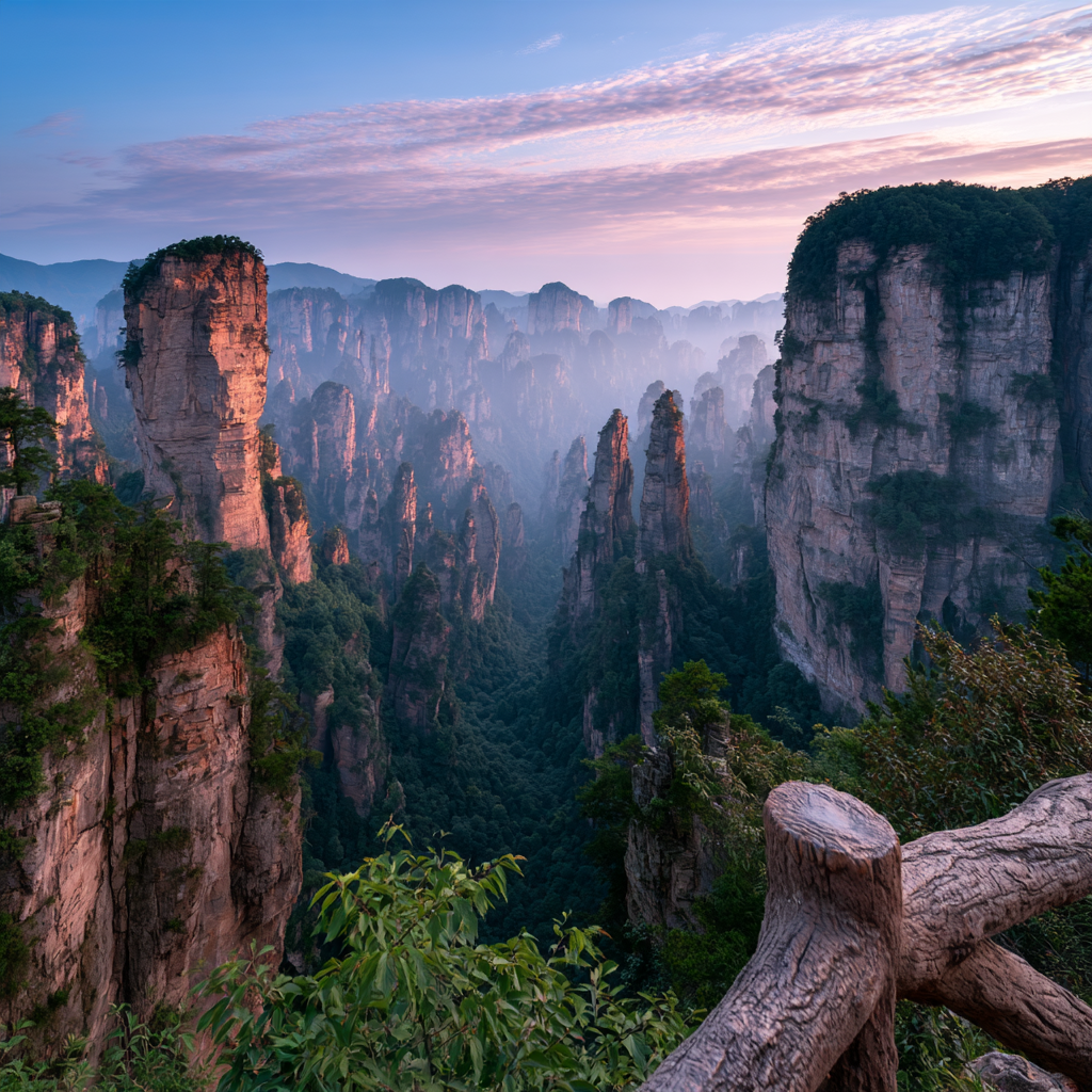
UNESCO describes a landscape of more than 3,000 sandstone pillars and peaks, many rising over 200 metres. That figure refers to the World Heritage property, not to formations visible from one platform. The scale explains why two photographs labelled simply Zhangjiajie can look quite different: one may show a distant field of pillars, another a single column above a wooded ravine. Your first task is to identify the experience you want within that larger landscape.
Understanding the Zhangjiajie National Forest Park location is therefore more useful than searching for one “Avatar mountain” pin. Decide which entrance and scenic areas your day will use, then check the relationship between those places and your accommodation. A room described as being in Zhangjiajie may still require a road transfer before you reach the relevant gate.
For accommodation, compare two separate map points: the hotel’s entrance and the gate your route actually uses. A convenient base is one that makes your chosen park days straightforward. A place close to one entrance may offer little advantage for a day starting elsewhere. If you arrive late, plan the arrival transfer and first morning separately; there is no need to squeeze the park into the arrival day just because your train reaches Zhangjiajie.
Choose the scenery you came for
Yuanjiajie is a practical starting point for visitors whose main interest is the tall, isolated pillars associated with the film imagery. Tianzi Mountain offers another upper-level viewing area. Golden Whip Stream gives a different perspective from the valley, looking toward the rock walls through the forest. These are choices within a park visit, not three interchangeable names for the same lookout.
The geopark’s published routes help connect these names with transport. Read the route as a sequence of an entrance, a shuttle journey, an ascent, a walking section and a descent. Merely counting attractions hides much of the day.
Use the right landmark name
The pillar widely nicknamed “Hallelujah Mountain” is Qiankun Pillar, also called Nantian Yizhu or Southern Sky Column. Hunan’s tourism department clarifies that the 2010 nickname was unofficial local marketing. Save the established names with your map pin; do not rely on the movie nickname alone when discussing a route.
Turn orientation into a first-day plan
Before booking accommodation, compare its actual map position with your intended entrance. Before booking transport, name the gate as well as the park. Before adding another attraction, allow for the return journey and your group’s walking pace. If the pillar scenery is the reason for coming, give it a dedicated day rather than treating it as a brief stop between unrelated sights.
A useful first-visit brief might read: one upper viewing area, time for a meal, and a confirmed route back to the same gate. Add a valley walk or a second upper area only after that outline works. Share the brief with anyone arranging transport, particularly if your group has different walking preferences. This turns a broad wish to see the floating-mountain scenery into a day that can be discussed, priced and adjusted without promising a particular photograph.
Next, use the guide to choosing scenic areas to narrow your priorities, or the map-reading guide to understand entrances and connections.